On our third day of renting a car in Iceland, we went to Þingvellir national park, a UNESCO World Heritage Site and one of the most popular destinations in the country. (That’s not a P, it’s a Þ, and it’s pronounced “th.” The park’s name is often written as Thingvellir.)

{as always, click images to enlarge, or mouse over for description}
Þingvellir is only 45 minutes’ drive from Reykjavík, but it has both historical-cultural significance (it’s the original site of Alþingi, the Icelandic parliament and the world’s longest-running extant parliament) and geographical distinction (it’s home to the Mid-Atlantic Ridge, where the North American and Eurasian tectonic plates meet). In spite of this, I didn’t really think it could outdo our wonderful hike (and hot river bath!) of the day before. However: it did.
As we were driving to the park we passed a little vista point over Lake Þingvellir, the largest natural lake in Iceland (there’s a reservoir that’s bigger). The view was incredible and the ground was covered with hundreds of little stone cairns and arrangements; some of them even spelled out messages in different languages. As we got out of the car we were blasted with wind so cold and powerful that I could barely breathe, so we ran out, took some pictures, and scrambled back into the car.


I’m not quite sure whether this place is technically part of Þingvellir, but if it’s not, it’s very close to the boundary. Soon we got into the park proper, and stopped at the info center to use the restrooms and buy some snacks. The parking lot had a good number of cars in it, including two tour buses, and the café tables in the center were full of Chinese, Japanese, and European tourists. This was our first sign that Þingvellir wasn’t going to be as nice and uncrowded as Hveragerði (where we’d been the day before).
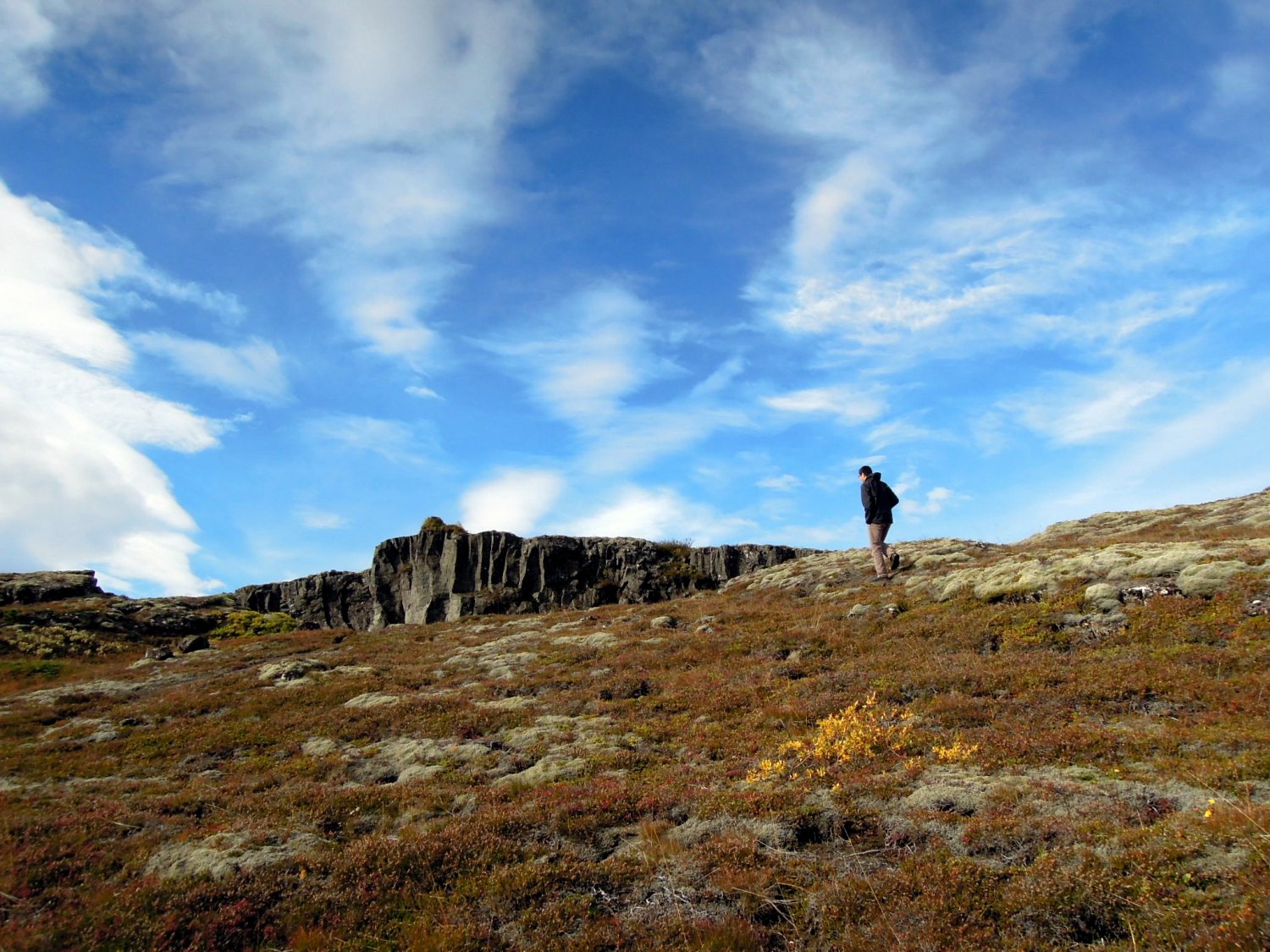
When we left the info center we had obtained no info, so we weren’t quite sure what to do next. We saw what looked like a trail branching off from the parking lot, so we took that, but it ended soon after. As we walked back to the car Erik griped, “Dumbest trail ever.” I agreed but felt compelled to point out that in such surroundings, no trail could really be that bad! The sun was shining and the Icelandic sky was its clearest and bluest, and there were grassy green mountains and dramatic grey cliffs in every direction.
After that we drove to another parking lot. There were a number of trails leading from there, and explanatory signs in Icelandic and English. We opted for the trail to our left, and soon found ourselves crossing a little bridge over a waterfall — to join dozens of other tourists in what, in uncrowded Iceland, felt like a total crush of people. (Oh, London and Istanbul are going to be culture shock indeed!) We saw whole parades of people coming out of tour buses; I remembered that when I’d browsed the schedule of bus day trips, many of them included short (1-2 hours) stops at Þingvellir. We were at what must be the tourist center of the park: an easy paved trail that takes in the pretty waterfall, the original “law rock,” a stunning network of streams and ponds, Almannagjá (the dramatic continental rift), and a viewing platform where we could survey all of this.


It was all really beautiful, but — and this made me feel really stupid and ungrateful — I couldn’t enjoy it. There were just so many people around, so many signs and tour buses, postcards for sale and families passing around bags of potato chips. It didn’t feel like Iceland’s greatest historical, cultural, and natural treasure; it felt like a tourist trap. Plus it was super windy so I was ready to be disgruntled over anything. We took pictures on the viewing platform and then there didn’t seem to be anywhere to go except back down the way we’d come. “It’s as I feared,” I thought. “Yesterday’s hike was the highlight of the countryside for us.”
But as we were heading back down the trail, I noticed a smaller dirt path leading into the center of the rift. “Want to try this?” I asked Erik, and he said sure. It was a very little trail that wound under trees and over rocks covered in moss and lichen. Within a few minutes, the other tourists’ chatter dissipated from our hearing, and we found ourselves alone. And not long after that, we got far enough into the rift that we couldn’t see the main tourist trail anymore.

The rift walls sheltered us from wind and sound, and at moments the air was utterly still, with only the bright midday sun to pierce it.


It was the most peaceful place I’d ever been — I couldn’t believe how close we were to the visitors’ center and the tour buses. At one point a crow flew overhead and we could actually hear its wings slicing through the air: a clean, cutting, feathered sound.


Sometimes the trail was almost obscured by all the grasses. The wind shelter must be good for plants. We walked on for quite a while, and the rift seemed never to end — it does run the length of the continental plates, I suppose! I don’t know how long we went; time didn’t seem to exist.

At just about the point when Erik decided he wanted his sammich, we passed under some power lines (it was quiet enough that we could hear their hum) and I spotted an accessible opening in the rift wall to our left. We climbed up, intending to sit on the top to eat. And then we got out and saw this:

There was a convenient, gently sloping boulder we could sit on. It was covered in that squishy moss we’ve come to love, and it made a cushy soft seat.


We were at Lake Þingvellir, and were amazed to discover that all along the rift there was a higher, paved path running parallel to the little dirt one we’d taken. I guess this paved path is for access to the many summer homes we saw along the lakeside; there was no driveable road. The summerhouse season must be ended though — the entire time we were here we saw only one other person, and she was a preteen girl taking a walk with her iPod and earbuds.

After picking our way over all those rocks in the rift valley, we thought it would make a nice change to walk on the paved trail, so we did so, continuing on in the same direction.

If we had ever thought Iceland would be a snowy, barren place (and parts of it are — the whole central highland is uninhabited), this walk proved the falseness of that notion. We saw evergreens and other trees, more mushrooms and fungi than I’ve ever seen in one place, mosses and lichens and foliage in almost every color, and three kinds of wild berries (red, black, and blue).


I lay down on the plant-carpeted rock face to take some of these photos and it was so lovely I could have taken a nap.


Not to mention the rock itself was interesting, too. In some places we found fissures so deep I was scared to go near them. In other places, the stone was patterned like flowing lava — from which it was probably formed.

It was a breathtaking place to walk. On one side we had the lake, glittering in the sun, and so clear that in some places we could even see the rocks on its bottom. Along the trail there were all the plants and fungi.
 rift valley.")
And on the other side, the hard stone (and deep below, the soft grass) of the continental rift. Horizontal space as far as the eye could see, and the dramatic vertical dips occasioned by the rift. The countless textures and colors of the plants and fungi and lichens. The occasional bird. And the two of us.


As far as we could tell, the path went on forever — maybe all the way along the lake, maybe beyond. At some point we had to turn around. We wanted more food, and some respite from the sun. So we returned along the paved trail.

As we drew nearer where we’d started, we realized we didn’t actually know where this trail led. When we reached the edge of Lake Þingvellir (also the end of the summer homes), we walked through a parking lot and then we were on the road itself, making our way between ponds.


The wind was up again, and in our faces. (When we got in the car later I realized I was windburned.) It felt like a long way back to the car, but with this view, how could I complain?


We finally reached the car and closed ourselves gratefully into its windless shelter. We drove back to the info center (again for the restroom and snacks), and then to another lake town — Laugarvatn — where we devoured a late lunch.

We got back to Reykjavík in a post-sun/wind/hike daze and sat around the apartment for a short while before heading back out. We went to a swimming pool, sat in the hot tub, and had hot dogs for dinner. I called my parents (over Skype), and then we went to bed. It was one of the best days I’ve ever spent. I still feel peaceful and happy, looking at the pictures and remembering how I felt when we were there. I’m sitting typing this in the National Library in Reykjavík, and it’s so weird to me that in this modern building we are only 45 minutes away from that timeless scenery. Iceland is so strange and cool and compelling. I’m really glad we came here.
Tomorrow: breakfast on a boulder: one last early-morning jaunt before returning the car!

I experienced Thingvellier with much tourists, too. But the area is so spacious that always find a quiet place for yourself, like you did.
Thanks for sharing!
Thank you for reading and commenting! It’s good to hear about your experience. The place must always be full of tourists! I’m so glad we didn’t just stick to the visitor area… you’re right, there must be always be good private places.
Beautiful! So nice to have found that other trail. Thanks for sharing. I really liked looking at the pictures and of course, reading your thoughts.
Oh, I’m so so glad we found it, because if we hadn’t I would have left Thingvellir thinking it was a tourist trap, and that would have been SO sad. Thank you for reading and commenting and looking at all the pictors. 🙂 I took probably two thousand pics during the 3 days we rented the car. ;b
So lovely! I remember having the same feeling of spaciousness and solitude on the desert in Nevada. It makes you realize how bizarre it is that we crowd ourselves together in cities. I think the fewer people there are per squar mile, the saner it is.
Yes! I think that’s one of the things I’ve most enjoyed about Iceland — that peace that comes with spacious surroundings. I’ve been thinking about where we might want to live when we stop traveling… after being here I just can’t think of returning to a place with a lot of traffic and congestion. But who knows how I’ll feel a few months down the line. 🙂
I haven’t been to the Nevada desert (or Utah, which I’ve heard is simply spectacular) — we must do a US road trip when we get back. 🙂
It will be interesting to see where you plant yourselves after this adventure. A few years ago we drove from Denver to Taos, another spacious, sparsely populated area of our country – and breathtakingly lovely. Anyway, something about Iceland obviously agrees with you. You glow with good health, and look so happy. (You aren’t pregnant are you? 🙂
Iceland definitely agrees with me! Not pregnant, but I can only hope that if I ever am, I’ll feel as happy and comfortable as I do these days! ;b
Stunning landscape!
(p.s I enlarged EVERY pic!) 😀
Eeeee, now that’s a compliment. 😀
Fabulous photos! Brings back many memories from 25 years ago. Thank you so much for sharing. I miss Iceland 😦
You’re welcome! I can see why — I’m already envisioning how much we’ll miss it once we leave! (What, no instant hot water?!)
Wow! These are lovely pics both in the touristy spots and in the off-the-path spots. Thanks for sharing. I’m glad I stumbled upon your blog! http://ohtheplaceswesee.com
Thank you for reading and commenting, Rusha! It was a magical place. 🙂
[…] lovely grassy hillside that just invited sinking into. I did actually sit on some of it; it was no Icelandic moss, but it was comfy enough, and I liked looking at the […]